
 Although running the same route over and over (and over) again can be comforting (after all, you know what's around the bend, how steep the road is, or how much longer you have to go), it can also become tedious and, well, kind of boring.
Fortunately, there are some fine mapping resources for the swift-footed adventurer in many of us. For example, Map my Run / and USA Track & Field's America’s Running Routes offer helpful suggestions for those who want to wonder off their oft-treaded track. I particularly like the simplicity of the Track & Field site, which provided me with dozens of local running-trail suggestions ranging from 3 to 10+ miles within easy proximity of my neighborhood.
But there are fascinating historical maps that can add new meaning to those same old trails. For example... the Library of Congress' Maps Collection (part of the "American Memory" digital project) provides access to thousands of historical maps, including the one featured in this post (which intersects with several of my running routes). The collection -- which actually represents only a fraction of the 4.5 million items held by the Library's Geography and Map Division -- can be searched by city, town, state, or broader region, and is also subdivided into categories such as Cultural Landscapes, Military battles and campaigns, and Transportation & communication. Try it out. You may uncover some cartographic treasures (even even the remnants of an old battleground in your own backyard). Note that the collection tends to be limited to items that are not owned through copyright protection (an added bonus for bloggers).
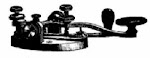
Other interesting sources for historical maps include Historical Topo Maps, "Historical Markers" sites (at Commonwealth of Virginia Historical Markers, I found a map displaying the Old Telegraph line that used to run through my county), and "Archives Wiki," which is sponsored by the American Historical Association. The Archives Wiki serves as a clearinghouse of information about archival resources (including historical maps and other snapshots in time) throughout the world. A colleague of mine also pointed out that Google Earth allows you to overlay historical maps; for example, you can place a copy of a Lewis & Clark 1814 map over your aerial domain. For more information, take a look at Spellbound Blog.
If any of you fellow runners are aware of other interesting map resources, I would be delighted to hear about them.
Happy trail mapping.
Sunday, February 24, 2008
"Mapping" your run
Sunday, February 10, 2008
Running a red light
 There's an adrenaline surge as I race down Rose Hill towards Telegraph, knowing that perfect timing is imperative. Either I'll beat the red light and possibly match my better time (about 35 minutes for this 4-1/2 mile run) or STOP completely, for at least a minute or two. I can see the light from the top of the hill. It's red, then green, and I'm running, running, running hard. I'm so close now, if it changes I'm going anyway. I nod to the waiting cars at the 4-way intersection, not knowing whether anyone actually sees me. I don't care, it's too late. Caution and sound judgment elude me. The unbridled racer in me -- the primordial essence that outruns the savage beast -- rises to the challenge of a changing traffic light, and I'm safely across the road. Whew.